Ọrọ Iṣaaju
This manual provides detailed instructions for the operation and maintenance of your Garmin GPSMAP 78sc 2.6-Inch Waterproof Marine GPS and Chartplotter. The GPSMAP 78sc series is designed for recreational navigation, featuring a bright 2.6-inch LCD color display, built-in basemap, and a high-sensitivity GPS receiver. All models are waterproof to IPX7 standards and float in water, making them suitable for boating and watersports. Key features include a built-in microSD card slot for additional maps and a dedicated Man Over Board (MOB) button.
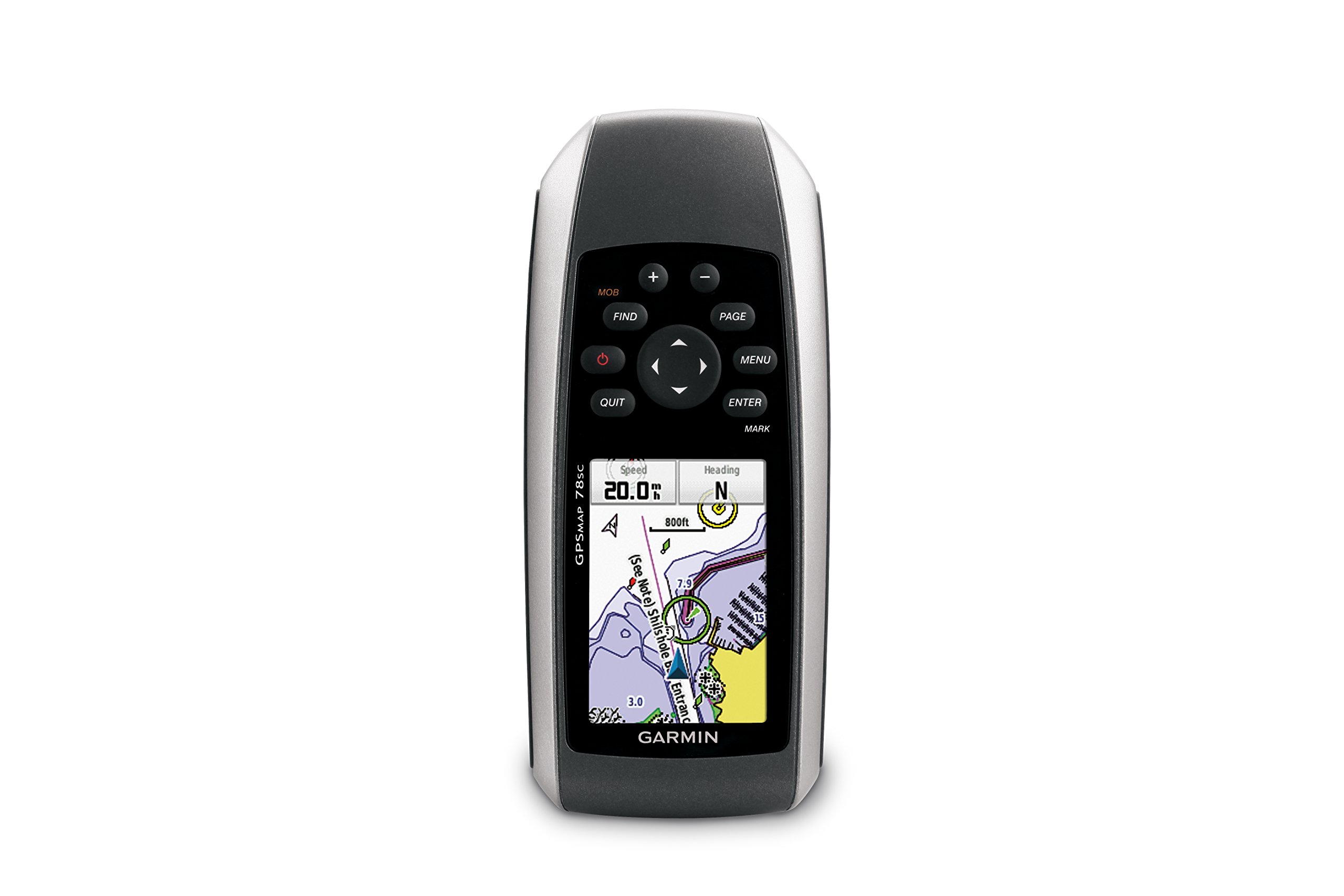
olusin 1: Iwaju view of the Garmin GPSMAP 78sc handheld marine GPS and chartplotter.
Ọja Pariview
Awọn ẹya pataki:
- Marine-friendly handheld with high-sensitivity GPS receiver and 2.6-inch color TFT display.
- Waterproof to IPX7 standards; floats in water.
- Built-in BlueChart g2 U.S./Bahamas coastal charts with shorelines, depth contours, navaids, harbors, marinas, and more.
- Built-in 3-axis tilt-compensated electronic compass and barometric altimeter for heading, altitude, and weather information.
- Wireless sharing of waypoints, tracks, routes, and geocaches with other compatible devices.
Kini o wa ninu apoti:
- GPSMAP 78sc device
- Okun ọwọ
- okun USB
- Afowoyi

olusin 2: Angled view of the Garmin GPSMAP 78sc, highlighting its button interface.
Awọn fidio ọja:
Garmin GPSmap 78 handheld GPS Overview
Yi fidio pese kan gbogboogbo loriview of the Garmin GPSMAP 78 handheld GPS, demonstrating its features and design.
Ọja Pariview Fidio
A concise product overview video from the seller, highlighting key aspects of the device.
Ṣeto
1. Awọn batiri fifi sori ẹrọ:
The GPSMAP 78sc operates on two AA batteries (not included). To install:
- Wa ideri iyẹwu batiri ni ẹhin ẹrọ naa.
- Twist the D-ring counter-clockwise to unlock and remove the cover.
- Fi awọn batiri AA meji sii, ni idaniloju polarity ti o pe (+ ati -).
- Replace the cover and twist the D-ring clockwise to secure it.

olusin 3: Pada view of the Garmin GPSMAP 78sc, illustrating the battery compartment.
2. Titan tabi Pipa:
Tẹ mọlẹ Agbara button (located on the left side) to turn the device on or off. A short press will adjust the backlight.
3. Eto akọkọ:
Upon first use, the device may prompt you to set language, time zone, and other preferences. Follow the on-screen instructions using the directional pad and WOLE bọtini.
Ṣiṣẹ
Navigation Basics:
- Akojọ akọkọ: Tẹ awọn Akojọ button twice to access the main menu.
- Bọtini Oju-iwe: Tẹ OJU to cycle through the main pages (Map, Compass, Trip Computer, etc.).
- Paadi itọsọna: Use the directional pad to scroll through menus, pan the map, or adjust settings.
- Tẹ Bọtini: Tẹ WOLE to select an item or confirm an action.
- QUIT Button: Tẹ JÁDE to return to the previous page or cancel an action.
Ṣíṣẹ̀dá Àwọn Ọ̀nà Ìbánisọ̀rọ̀:
To mark your current location as a waypoint:
- Tẹ awọn SAMI bọtini.
- Edit the waypoint name, symbol, and coordinates if desired.
- Yan Ti ṣe or Fipamọ to store the waypoint.
Man Over Board (MOB) Function:
Ni pajawiri, tẹ MOB button to immediately mark the current location and initiate navigation back to that point. This feature is critical for safety in marine environments.
Itoju
Ninu Ohun elo naa:
Wipe the device with a cloth dampened with a mild detergent solution. Dry thoroughly. Avoid using abrasive cleaners or solvents that could damage the device's finish or screen.
Itọju Batiri:
Always use fresh, high-quality AA batteries. If the device will not be used for an extended period, remove the batteries to prevent leakage and corrosion.
Awọn imudojuiwọn sọfitiwia:
Periodically check the Garmin website for software updates to ensure optimal performance and access to the latest features. Updates can typically be installed by connecting the device to a computer via the USB cable.
Laasigbotitusita
Ẹrọ ti ko ni agbara:
- Rii daju pe awọn batiri ti fi sori ẹrọ daradara ati pe wọn ti gba agbara ni kikun.
- Try new batteries.
- Ṣayẹwo awọn olubasọrọ batiri fun ipata.
Ifihan GPS ti ko dara:
- Rii daju pe ẹrọ naa ni oye view ti ọrun.
- Avoid areas with tall buildings, dense foliage, or other obstructions.
- Allow sufficient time for the device to acquire satellites, especially after being off for a long period.
Iboju Ko dahun:
- Perform a soft reset by removing and reinserting the batteries.
- Rii daju pe iboju jẹ mimọ ati laisi idoti.
Awọn pato
| Ẹya ara ẹrọ | Ẹ̀kúnrẹ́rẹ́ |
|---|---|
| Brand | Garmin |
| Orukọ awoṣe | GPS maapu |
| Nọmba awoṣe | 010-00864-02 |
| Iwon iboju | 2.6 inches |
| Ifihan Iru | LCD |
| Ipinnu | 160 x 240 awọn piksẹli |
| Mabomire Rating | IPX7 (floats) |
| Igbesi aye batiri | 20 Hours (typical) |
| Batiri Iru | Awọn batiri AA 2 (kii ṣe pẹlu) |
| Agbara Ibi ipamọ Iranti | 1 GB |
| Compatible Flash Memory Type | microSD |
| Eto Lilọ kiri Satẹlaiti atilẹyin | GPS |
| Pataki Awọn ẹya ara ẹrọ | Rugged case, Barometric altimeter, Garmin Connect compatible, Electromagnetic compass, Garmin HotFix, Custom POIs, Automatic routing, Hunt/fish calendar, Geocaching, Photo navigation |
| Awọn iwọn Nkan L x W x H | 2.6"L x 1.2"W x 6"H |
| Iwọn Nkan | 7.7 iwon |
Atilẹyin ọja ati Support
The Garmin GPSMAP 78sc comes with a 1 Year Limited Warranty. For detailed warranty information, product support, or service inquiries, please refer to the official Garmin website or contact Garmin customer service directly. The included manual also contains contact information and further support resources.